« Mapper in Residence » bei der Stadt Winterthur im November 2023

Stefan Keller von der OST Ostschweizer Fachhochschule und SOSM-Vorstandsmitglied wird « Mapper in Residence » bei der Stadt Winterthur für vier Freitage im November 2023 (*).

Als Mapper in Residence (MiR)…

  • dient er als Bindeglied zwischen einer Organisation – in diesem Fall der Abteilung Geoinformation der Stadt Winterthur – und der OpenStreetMap (OSM) Community.
  • fördert er das Verständnis für OpenStreetMap unter den Mitarbeitenden der Organisation, z.B. durch Veranstaltungen.
  • fördert er die Verbesserung von OpenStreetMap-Inhalten und -Prozessen durch die Community.

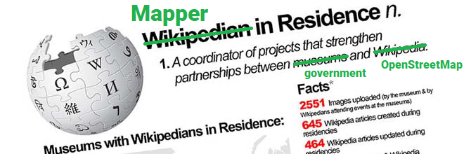
Ein:e Mapper in Residence initiiert bzw. stärkt letztlich die Partnerschaft zwischen der Organisation und der OpenStreetMap-Community. Das kleine Projekt ist inspiriert von « The Wikipedian in Residence ».

Stefan Keller wird unter anderem Daten und Prozesse identifizieren und Werkzeuge verbessern und spezifizieren. Dies um mehr offene Daten der Stadt Winterthur in OpenStreetMap zu integrieren und um diese in OpenStreetMap aktuell zu halten. Dies könnte auch zu einer Verbesserung und Erweiterung des « Leitfadens für Dateneigentümer » (**) von 2021 führen.

(*) Siehe auch diese Mitteilung auf LinkedIn der Stadt Winterthur vom 30. Oktober 2023.
(**) Hitz-Gamper, B. S., & Stürmer, M. E. (2021). Daten in OpenStreetMap integrieren – ein Leitfaden für Dateninhaber. DOI: 10.48350/159438. Download (PDF).

Benches are a social institution – like OpenStreetMap!

The project of the month Switzerland (PotM CH, see below) from August 2022 is about the registration of benches in OpenStreetMap. Benches are a social facility for young and old – just like OpenStreetMap! A change simply counts as adding or changing from the tag amenity=bench and optionally other tags like color. The data is updated hourly.

A dashboard (no. 23) shows the changes of this PotM CH since the beginning of August. The time period can be adjusted in the filter at the bottom right. To display the benches, one can use standard map style on OSM.org, zooming in all the way. A useful webapp is also the OpenPOIMap.

More information about this PotM CH can be found on this Wiki page, where by the way also own projects (« Challenges ») can be proposed.

Benches in OpenPOIMap around Bellevue, Zürich (Switzerland).

P.S. The « Project of the Month Switzerland » (PotM CH) is about working together on a specific OpenStreetMap topic. This way, mappers can be made aware of a topic and/or newcomers to a topic can be introduced to OpenStreetMap. It is also used for targeted data improvement.

XKCD #636 (Licensed under CC BY-NC 2.5).

Projet du mois en Suisse (PotM CH) avril 2022 Offres durables

Le « Projet du mois en Suisse » (PotM CH) d’avril 2022 vise à recenser les offres durables, c’est-à-dire les boutiques et les distributeurs qui sont bio, régionaux, sans emballage, issus du commerce équitable ou de seconde main, ainsi que les restaurants végétariens et végétaliens et le partage de nourriture, y compris le Water Refill. Notez les tags et les clés pertinents dans la documentation PotM [1]. La carte web « Sustainable » [2] de l’utilisateur ToastHawaii représente joliment la plupart des objets.

Figure 1: Tableau de bord (dashboard) des offres durables du PotM CH avril 2022.

Tableau de bord et classement

Le tableau de bord (dashboard) PotM-CH d’avril 2022 a reçu le numéro 19 [3]. Comme jusqu’à présent, il présente un classement des noms de mappeurs qui ont le plus édité. Les utilisateurs geo_max et Geonick, qui occupent actuellement la deuxième et la troisième place, sont d’ailleurs hors concours. Ce sont donc imagoiq, sampeto et Necessary_Function qui occupent actuellement les trois premières places.

Prix et Mapathon/Hackathon 29. Avril 2022

Le PotM CH d’avril 2022 est une action très spéciale qui permet de gagner des prix : Les trois mappeurs les plus assidus recevront des petits coffrets cadeaux de la ferme ! Les prix seront remis lors du Mapathon/Hackathon Rapperswil 2022, qui aura lieu le vendredi après-midi 29 avril prochain [4]. Il reste encore des places disponibles pour ce Mapathon/Hackathon (« Ask us Anything »).

Semaine du développement durable (« Nachhaltigkeitswoche ») Rapperswil 2022

Les prix du PotM CH et les pizzas et boissons du Mapathon ont été sponsorisés par la Semaine du développement durable (« Nachhaltigkeitswoche ») Rapperswil 2022 (NHWR22). Voici le programme complet de la #NHWR22 [5].

Que signifie « durable »?

Le terme « durable » a été défini de manière assez restrictive dans ce PotM. On entend par là beaucoup plus de choses, comme par exemple des offres de réparation gratuites, le partage de voitures et de vélos ou l’élimination écologique des déchets. Une grande partie de ces projets a déjà été proposée dans la documentation du PotM [2] et pourrait être mise en place dans les prochains mois.

Tu as une idée pour un « projet du mois »?

Si tu as une idée pour un PotM CH, il te suffit d’écrire dans la documentation/le wiki [1] ou de te manifester sur l’un des canaux mentionnés dans l’aide ici [6].

Happy mapping!

Link:

[1] Documentation/Wiki pour PotM CH: https://wiki.openstreetmap.org/wiki/DE:Project_of_the_month_Switzerland
[2] Carte web « Sustainable »: https://sustainable.zottelig.ch/de/
[3] Tableau de bord 19 « Offres durables »: https://potm.osm.ch/superset/dashboard/19/
[4] Mapathon/Hackathon Rapperswil 2022, 29 avril 2022: https://giswiki.hsr.ch/4._Mapathon_Rapperswil_2022
[5] Semaine du développement durable Rapperswil 2022: https://www.sustainabilityweek.ch/event/4-mapathon-rapperswil/
[6] Aide OSM.ch: https://osm.ch/hilfe.html

Projet du Mois Suisse (PotM CH) Juillet 2021 Campings et Aires de Camping-Car

Le moment est venu: le « Projet du Mois Suisse » – en anglais « Project of the Month Switzerland », en bref PotM CH – a commencé! L’idée est de travailler ensemble sur un sujet spécifique d’OpenStreetMap. De cette façon, les cartographes peuvent être sensibilisés à un sujet et les nouveaux venus à un sujet peuvent être initiés à OpenStreetMap (OSM). Il est également utilisé pour l’amélioration ciblée des données (« Collecte de données dirigée »). L’idée vient du « Projet du mois » français et du « Schwerpunkt der Woche » allemand, entre autres.

Page Wiki pour PotM CH et tableau de bord PotM CH

Une page wiki pour PotM CH [1] a été créée et une application web PotM CH [2] a été mise en place. La page wiki explique à nouveau de quoi il s’agit et la webapp PotM CH montre dans un tableau de bord avec des graphiques les mappeurs actifs et la progression.

PotM CH juillet 2021 Campings et aires de camping-car

Le PotM CH juillet 2021 est consacré aux terrains de camping et aux aires de camping-car. Utilisez le tag « tourism=camp_site » pour les terrains de camping et le tag « tourism=caravan_site » pour les aires de camping-car. Vous trouverez d’autres conseils sur la page wiki de PotM CH [1]. Important: Toujours marquer les changesets avec #potmch !

Actions suivantes et StreetComplete et MapComplete

Les prochaines actions sont déjà planifiées et vous pouvez participer et suggérer d’autres actions ou sujets! Il suffit de modifier la page wiki mentionnée [1]. Si vous voulez faire un travail de pionnier, vous pouvez également configurer StreetComplete ou MapComplete! Sur la page wiki de PotM CH, vous trouverez les liens d’aide correspondants.

Rejoignez les campings du PotM CH juillet 2021! Qui montera sur le podium en juillet?

Liens:
[1] Page Wiki pour le PotM https://wiki.openstreetmap.org/wiki/FR:Project_of_the_month_Switzerland
[2] PotM CH Dashboard Webapp https://potm.osm.ch/superset/dashboard/13/

Photos panoramiques des rues de Vevey

La Ville de Vevey a mis en ligne sur le portail Cartoriviera les données issues d’un relevé de type « mobile mapping » qui a eu lieu en fin d’année passée. Les 45 km du réseau routier de Vevey ont été parcourus et des images ont été prises tous les 3 mètres (les personnes et plaques minéralogiques sont floutées).

Ces données sont en libre accès sur Internet https://cartoriviera.ch/rues-vevey, et ces images sont à disposition pour digitalisation. Utilisez la source suivante dans les changesets basés sur ces données :

« Ville de Vevey – Photos panoramiques des rues 2020 – https://cartoriviera.ch/rues-vevey »

Merci à la Ville de Vevey

Use of swisstopo data and products with and in OpenStreetMap

As announced in our previous post, from the beginning of this month (March 2021), geodata and products from Federal Office of Topography (swisstopo) have been available on far less restrictive terms than previously.

As I noted then we didn’t have details available at the time so couldn’t comment further on the use of this data in OSM. In the meantime the terms are available and are limited to an attribution requirement which however applies downstream too. In the case of an use in OSM this would require products using our data to display attribution to swisstopo, this might seem to be an easy to fulfil requirement, but our licence specifically allows use that only credits the overall source of the data (that is the OpenStreetMap project). Considering the 100’s if not 1’000’s of 3rd party sources and 1.6 million individual contributors, this makes a lot of sense. But as a consequence this rules out direct use in OpenStreetMap till we have agreed alternative arrangements with swisstopo.

But it isn’t all gloom and doom, we have already agreed that we can make swisstopos high quality orthophoto product « swissimage » available in OSM editing apps and naturally applications that combine OSM and swisstopo, for example a map with swisstopo derived hill shading, is possible as long as swisstopo is credited.

It will take a bit until configuration updates have reached the major editors, if your favourite one supports custom imagery backgrounds from WMS servers you can add swissimage manually with

https://wms.geo.admin.ch/?FORMAT=image/vnd.jpeg-png8&TRANSPARENT=TRUE&VERSION=1.3.0&SERVICE=WMS&REQUEST=GetMap&LAYERS=ch.swisstopo.images-swissimage&STYLES=&CRS={proj}&WIDTH={width}&HEIGHT={height}&BBOX={bbox}

the above will work for JOSM, for Vespucci replace {proj} with EPSG:3857. The images are from flights in 2017 to 2020 (Map) in some cases we have access to cantonal imagery that is more recent. Please note that use of swisstopo infrastructure is subject to additional terms of use that should be respected.

To keep up with the developments, follow us on twitter @SwissOSM and subscribe to the Swiss OSM community mailing list.

Update September 14th 2021: swisstopo has now clarified that central attribution is acceptable for uses that combine many different data sources. See https://www.swisstopo.admin.ch/de/home/meta/konditionen/geodaten/source.html

Background aerial imagery ©swisstopo, map data ©OpenStreetMap.

Welcome swisstopo!

Today we are welcoming the Swiss Federal Office of Topography (swisstopo) to the open data community. After many years of free access for consumers, today, finally, it is providing reusable open government data that can be used to build and enrich new applications and datasets.

This is a high point of a development of open data availability in Switzerland in which the cantons have been leading for many years starting with the Canton Solothurn over a decade ago and is now policy in nearly all of them.

What does this mean for OpenStreetMap?

Short term nothing is going to change. While at the time I’m writing this we don’t have access to the final terms of use, we do have a good idea of what the content will be and some of the terms will not be completely compatible with our distribution licence, the ODbL. This rules out direct inclusion in our data, but will allow use as reference data for quality assurance. We are negotiating with swisstopo for compatible access terms, just as we have previously done for the municipality administrative boundaries way back in 2011 and more recently for use of the GWR address data and expect these issues to be resolved soon.

The most interesting data for us right now is access to swisstopos « swissimage » aerial imagery. This will at last provide us with good coverage in Switzerland’s mountainous regions, something that has been sorely missing from the global orthophoto mosaics.

To keep up with the developments, follow us on twitter @SwissOSM and subscribe to the Swiss OSM community mailing list.

Map image ©swisstopo