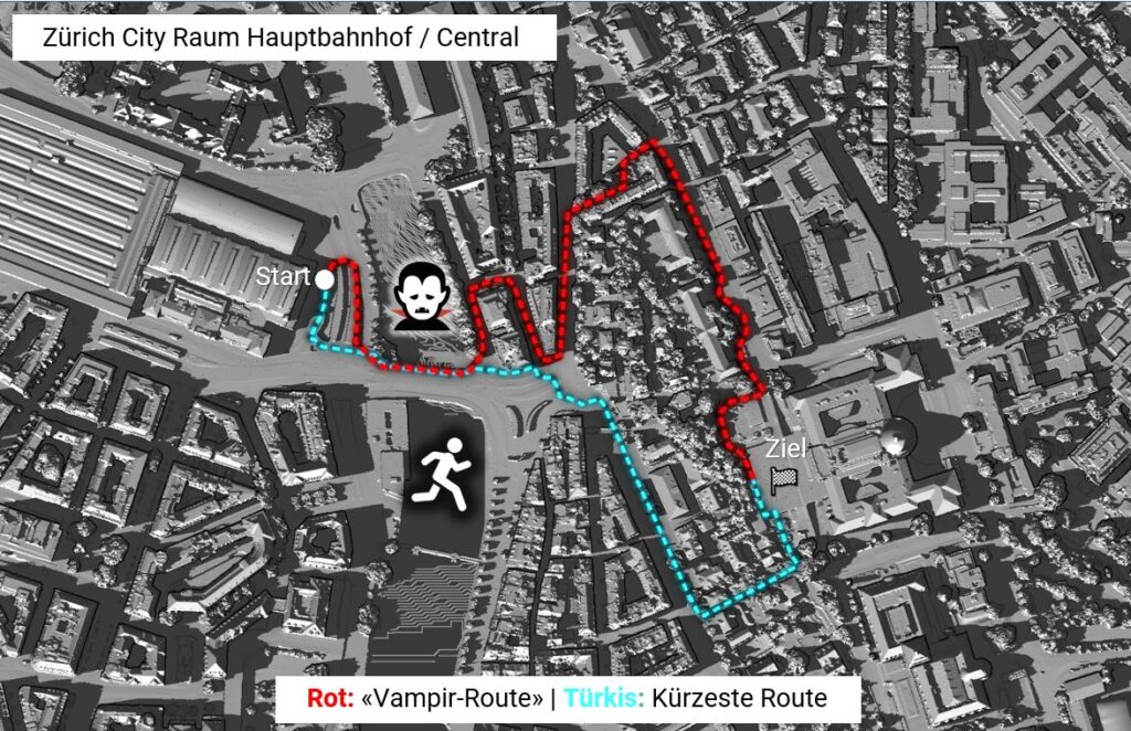
Climate change and increasing urbanization are causing more and more heat, which is particularly noticeable these days. Locals and tourists are therefore looking for ways to avoid direct sunlight. Of course you can change sides of the road, but this is not always possible – and Google Maps doesn’t offer any help.
The “vampire routing” proof-of-concept, also known as “vampire mode”, solves this problem with a new type of technology. It suggests footpath routes that preferably run in the shade – just like vampires that avoid the sun at all costs. A small detour can also be accepted.
The benefits are manifold: City residents and tourists benefit from cooler routes in summer. City administrations can supplement their heat reduction strategies. And tourist destinations receive a tool to improve quality of life and visitor management at the same time.
The innovative application was developed by a team of software engineers led by Professor Stefan Keller from the OST – Department of Computer Science at the Rapperswil-Jona campus. It combines methods from geoinformatics, climatology and spatial planning. The core of the proof of concept consists of a combination of open data and open source software. The footpaths, for example, come from OpenStreetMap, the world’s leading source of open map data, which is also used by emergency services. The shadow was calculated from point cloud data from swisstopo (swissSURFACE3D). This was used to simulate the shadows cast by buildings and trees on footpaths for a specific time of day. These and other criteria are incorporated into the OSM traffic network and the application’s footpath graph.
As a demonstration, the “vampire mode” was implemented for the area of the city of Zurich on August 1 at 16:00 and made available on the servers of SOSM. Radio SRF 1 (in the Regionaljournal ZH/SH), SRF 3 and SRF online reported on this on July 1 and 2, 2025.
Future versions could take into account hourly sun positions or paths with a slight incline and thus further increase the added value. We are happy to invite tourism professionals and other cities to cooperate with us in order to bring the application to other regions.
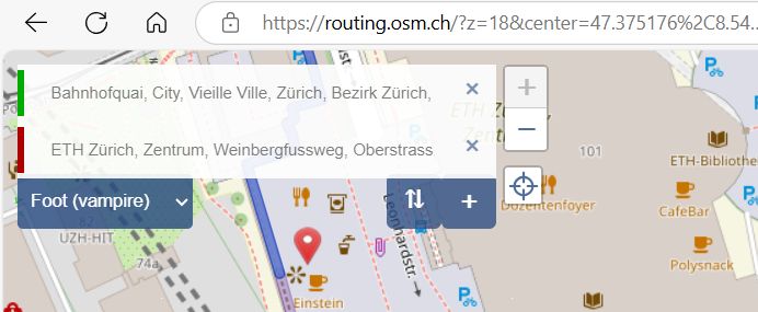
Go to the website https://routing.osm.ch. Select “Foot (vampire)”, enter the start and end (both must be within the city of Zurich) and the coolest route will be displayed.