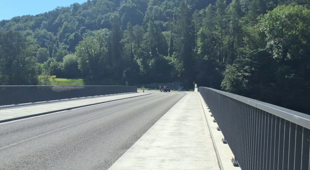
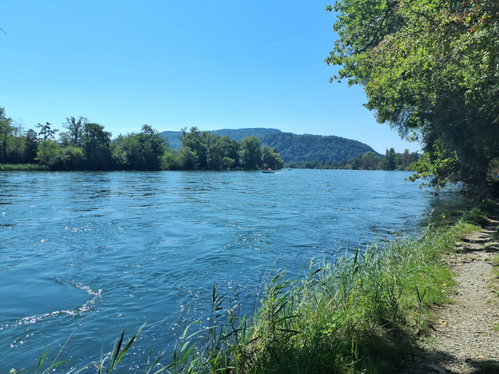
We approached Rheinau from three sides, mapping along the way. Meeting at the pool was a good decision, as it was a quite hot day.
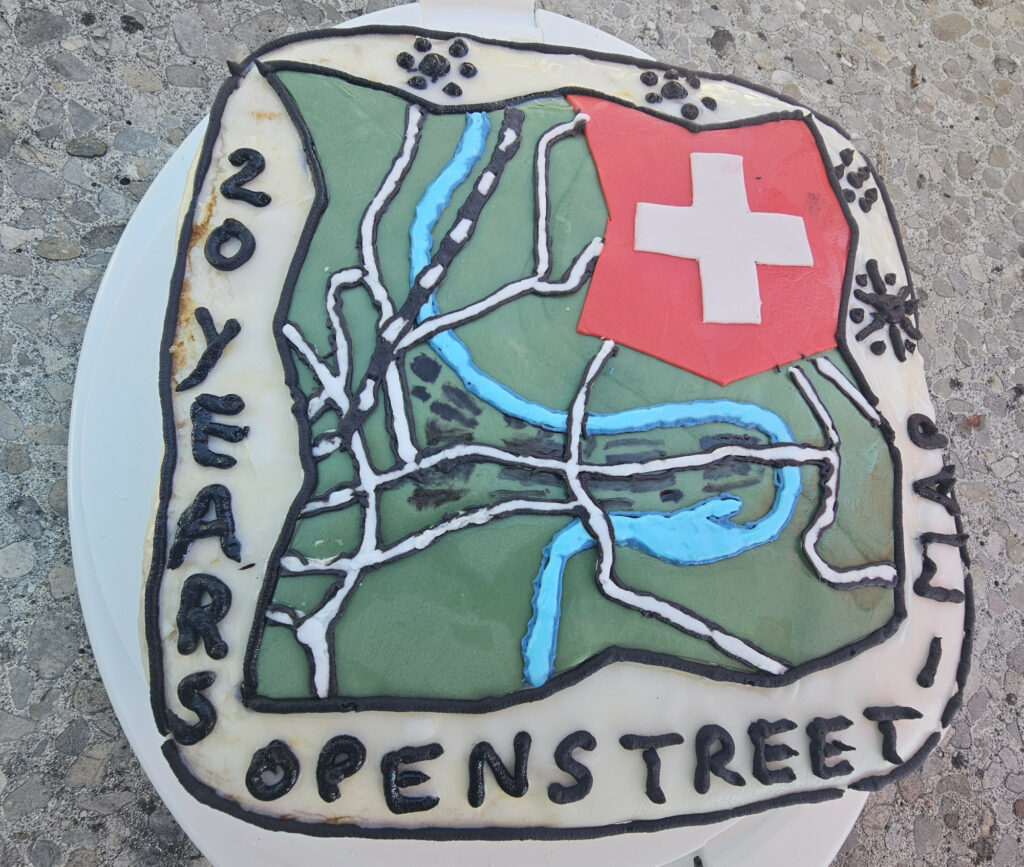
And of course there is no OpenStreetMap birthday without a cake

We approached Rheinau from three sides, mapping along the way. Meeting at the pool was a good decision, as it was a quite hot day.
And of course there is no OpenStreetMap birthday without a cake
The newest episode of the geomob podcast features a quite active Swiss mapper, Simon, who happens to be the the current president of the Swiss OpenStreetMap association. Tune in to hear about his motivation for the project, and his perspective on the OpenStreetMap community and its future.
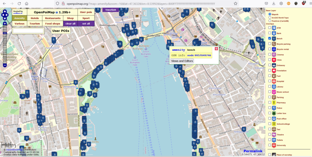
The project of the month Switzerland (PotM CH, see below) from August 2022 is about the registration of benches in OpenStreetMap. Benches are a social facility for young and old – just like OpenStreetMap! A change simply counts as adding or changing from the tag amenity=bench and optionally other tags like color. The data is updated hourly.
A dashboard (no. 23) shows the changes of this PotM CH since the beginning of August. The time period can be adjusted in the filter at the bottom right. To display the benches, one can use standard map style on OSM.org, zooming in all the way. A useful webapp is also the OpenPOIMap.
More information about this PotM CH can be found on this Wiki page, where by the way also own projects (“Challenges”) can be proposed.
P.S. The “Project of the Month Switzerland” (PotM CH) is about working together on a specific OpenStreetMap topic. This way, mappers can be made aware of a topic and/or newcomers to a topic can be introduced to OpenStreetMap. It is also used for targeted data improvement.

The “Project of the Month Switzerland” (PotM CH) of April 2022 is about the collection of sustainable offers, i.e. stores and vending machines that are organic, regional, unpackaged, fair trade or second hand, and vegetarian and vegan restaurants as well as food sharing including water refill. Note the relevant tags and keys in the PotM documentation [1]. The “Sustainable” web map [2] by user ToastHawaii nicely depicts most of the items.
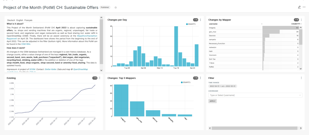
The April 2022 PotM-CH dashboard was given the number 19 [3]. As before, it shows a ranked list of the mapper names that have edited the most. By the way, users geo_max and Geonick, currently ranked second and third, are out of contention. So currently imagoiq, sampeto and Necessary_Function are on the first three places.
The April 2022 PotM CH is a very special promotion with prizes to be won: The three most diligent mappers will receive small gift boxes from the farm! The prizes will be awarded at the Mapathon/Hackathon Rapperswil 2022, which will take place next Friday afternoon, April 29 [4]. There are still places available at this Mapathon/Hackathon (“Ask us Anything”).
The PotM CH prizes and pizza and drinks from the Mapathon were sponsored by Sustainability Week Rapperswil 2022 (NHWR22). Here is the whole program of the #NHWR22 [5].
The term “sustainable” has been defined rather restrictively in this PotM. It actually means much more, such as free repair offers, car and bike sharing, or environmentally sound waste disposal. Much of this has already been proposed in the PotM documentation [2] and could be done in the next months.
If you have an idea for a PotM CH, just post it in the documentation/wiki [1] or get in touch on one of the channels mentioned in the help here [6].
Links:
[1] Documentation/Wiki for PotM CH: https://wiki.openstreetmap.org/wiki/DE:Project_of_the_month_Switzerland
[2] Sustainable web map: https://sustainable.zottelig.ch/de/
[3] Dashboard 19 “Sustainable offerings”: https://potm.osm.ch/superset/dashboard/19/
[4] Mapathon/Hackathon Rapperswil 2022, April 29, 2022: https://giswiki.hsr.ch/4._Mapathon_Rapperswil_2022
[5] Sustainability Week Rapperswil 2022: https://www.sustainabilityweek.ch/event/4-mapathon-rapperswil/
[6] OSM.ch Help: https://osm.ch/hilfe.html

Last Friday, October 23, 2020, DINacon 2020 took place – unfortunately only virtually like all conferences during this time. DINAcon stands for “Digital Sustainability Conference” and is under the patronage of the CH Open association. At this event future-oriented projects and approaches from the Open Source and Open Data Communities, from public administration and the economy are presented, discussed and awarded.
The program also included a session on the “Public OSM Partnership” (POP Study) by Stefan Keller.
And again the DINAcon Awards were presented. The shortlist included the “Defikarte der Schweiz” (www.defikarte.ch) in the category “Community Award” and a JOSM Plugin in the category “Best Newcomer Award”.

Finally the JOSM Plugin won in the category “Best Newcomer”! This category honors “Open Source projects that are not older than three years and offer exciting new approaches”.
The JOSM plugin “NeTEx Converter”, is a project for the JOSM editor, which collects and exports information about public transport – i.e. the infrastructure of stations – from OSM into this standardized XML structure. The NeTEx/XML file can then be further processed in various applications. Main developer is the student Labian Gashi who studies Computer Science in the masters program at HSR Rapperswil (now OST Campus Rapperswil). The work was supervised by Prof. Stefan Keller and specialists from the SBB.
It’s nice that another OpenStreetMap technology was awarded by this Open Source/Open Data conference. Already in 2019 the project OpenSchoolMaps won the trophy in the category “Best Open Education Project” (we reported here on SOSM.ch).
The map service bleibtoffen.ch allows everyone to find open shops and share information about open locations with a few clicks. The new service is based on the community project OpenStreetMap. Anyone can also report changes at bleibtoffen.ch. This information is then directly integrated into OpenStreetMap – in addition to the many volunteers who already add to OpenStreetMap on a daily basis.

In France, there are already some cities like Lyon and municipalities like Montrouge that are using “It stays open” (in French “ça reste ouvert”) as a means of communication in dealing with the Covid19 crisis.
Therefore, dear authorities and location promoters: inform your citizens and companies about this useful tool in dealing with and containing Covid19!
You can read more about this in the blog post of bleibtoffen.org (in german). Here you can go directly to bleibtoffen.ch. If you have any questions please contact us at SOSM (see contact).
At the annual general meeting end of March we presented our yearly activity report. Some of those activities were already reported in this blog:

Keen visitors may have noticed, we’ve re-launched our osm.ch site. Thanks to Flavio and Claudia and Michael for making the website more modern and professional looking. Comments on the new site are always welcome. Either here in the comments, as a mail to us, or by opening an issue on github or even a pull-request.

With a new logo designed by Roman, we finally came around to produce stickers. We distributed one sticker to each member with the invitation to our annual general meeting. In case you would like to get some stickers, just ask. We will gladly send you a couple of them.
Wikimedia und OpenStreetMap wollen in der Schweiz enger zusammenarbeiten. Den Anfang soll ein gemeinsames schweizerisches Burgen-Verzeichnis mit Karte, Fotos und weiteren Informationen machen.
Für den Samstag, 27. April 2019, ist ein Arbeitstreffen beider Communities und weiterer Interessierter auf Schloss Lenzburg (AG) geplant, um die verschiedenen Arbeiten zu koordinieren und sich gegenseitig die verschiedenen Projekte und Unterprojekte näher zu bringen.
Wikipedianer und weitere Interessierte erhalten eine Einführung in OpenStreetMap. Mapper und weitere Interessierte bekommen Wikipedia-Projekte nähergebracht. Am Nachmittag stellen Experten die Projekte OpenStreetMap, Wikipedia sowie Wikivoyage, Commons (Fotos) und evtl. Wikidata näher vor. Sie werden zeigen, wie man editiert, und stehen für Fragen zur Verfügung. (“Ask Us Anything”)
Das Ziel ist die vollständige Darstellung aller Burgen und Schlösser auf OpenStreetMap (OSM) und Wikipedia (WP), angefangen mit den Kantonen Aargau und Zürich.
Weitere Informationen und Anmeldung zur kostenlosen Teilnahme auf dieser Wiki-Seite.