We have a new set of tiles in LV95 projection (aka. CH1903+ or EPSG:2056). It is the standard osm.ch style, rendered with mapnik in LV95. You can look at it on the test page http://www.osm.ch/chlv95.html. This is our first try, without having real applications for it yet. Feedback would be welcome. If you find this useful or if you find any issues, please leave a comment.
The tile server URL template is http://tile.osm.ch/2056/{z}/{x}/{y}.png
Geonick told us in the comments that LV03 (the “old” one from 1903) is still widely used. For now tiles in both projections will be served. To keep the load low on the server, we would like to serve only one set of swiss projected tiles. So depending on usage and performance requirements we might shut down one set of tiles in the future. The test page for LV03 is at http://www.osm.ch/chlv03.html. The tile server URL template is http://tile.osm.ch/21781/{z}/{x}/{y}.png
I had a presentation at the FOSSGIS conference in Rapperswil about the data quality of OpenStreetMap in Switzerland (recording and presentation in German).
Some of the analysis was already posted to this blog previously (post about street names). But there is also a lot of new stuff in this presentation.
Address density
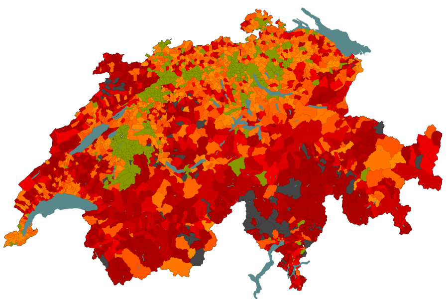
This map shows house numbers per person, so it shows where we already have lots of house numbers. For more details see the address layer of qa.poole.ch. As a reference value there is the address import of Denmark with a density of 0.4 addresses per person.
Public Transport
The railway network was completed in 2010 in OSM. Interestingly, the length continued to grow. By now, most of the network is mapped with track accuracy.
Points of interest
It is quite difficult to get reliable references for points of interest. One source I found is the “BFS Betriebszählung 2005”. It knows 23’077 restaurants and 4’683 hotels in Switzerland. OSM has about 10’000 restaurants and 2’500 hotels.
Hiking cycling and skating routes
Hiking routes in OSM: 10’103km
Hiking routes according to wandern.ch 60’000km
Cycling routes in OSM: 7’957km
National routes are complete in OSM: 3’452km (officially on veloland.ch 3’242kmb)
Regional routes 4’581km (not yet complete)
Skating routes in OSM: 678km
National routes 460km (of 625km according to skatingland.ch)
How will we continue?
Will the mapping activity stay the same, and will we have:
Just in time for FOSSGIS 2013 our technical team has launched osm.ch. Many thanks to MIPLAN AG for transferring the ownership of the domain to us. Osm.ch will be the home of all services provided by SOSM to assist mappers in Switzerland.
On Saturday SOSM had its first regular Annual General Meeting. To make it a bit more interesting we combined it with a mapping party in Moutier and surroundings, a slightly undermapped region in the Bernese part of the Jura. More on that later.
The highlight of the AGM was the election of three new members to the board replacing Stéphane Henriod who is extremely busy with HOT related activities and is most of the time in far away countries and Thomas Ineichen. A big thank you to both for the work they did in the first half year of SOSM.
The newly elected board members are
Pascal Mages (treasurer)
Philipp Schultz (assessor, press)
Patrick Stählin (press)
They join the incumbent boad members, Sarah Hoffmann and myself, that were duly reelected, as were the auditors Otto Wyss and Arthur Bonino.
The assembly passed a budget that includes funds for a leased server for SOSM services and we expect to announce what will be available in the immediate future.
Detailed minutes will be available in short while on this site.
Back to the fun stuff.
Half of Moutier has been mapped for quite some time, however aerial imagery for the 2nd part and for the villages in the same valley just became available early this year.
Prior to Saturday we did some armchair mapping resulting in this:
Screenshot from qa.poole.ch, red are mostly roads that were traced from imagery. As you can see a number of the villages didn’t actually have anything mapped. Nothing to feel all too bad about:
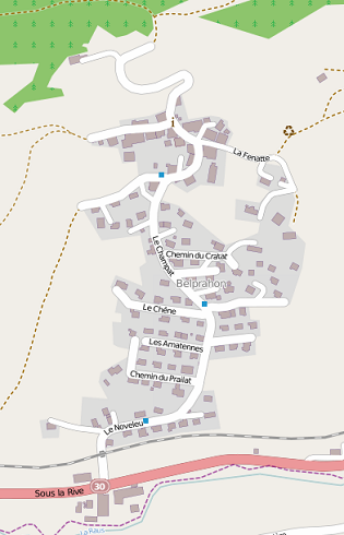
The picture shows what commercial navigation data was for the village Belprahon roughly in the year 2000, everybody starts small as you see. With the data gathered on Saturday the valley looks like this
Most of the remaining red is due to roads not being signposted or not having names in the first place, not to forget that the house numbers seemed to be really small on average making them extremely difficult to read. The result is not perfect, but a lot better than before and the village of Belprahon now looks like this in OSM
bing has updated its coverage of Switzerland for the 2nd time this year over the last days, leaving just three larger areas uncovered with high resolution imagery.
Areas that now have coverage all of Graubünden (including the Engadina), substantial parts of the Ticino and Valais plus small additions in the canton Berne. For a number of Swiss tourists resorts the additions will over time result in substantially better coverage by OpenStreetMap and this will be a boon for their guests.
You can find the full agenda here. After the meeting there will be an informal lunch and a mapping party. All interested parties can join for lunch (space permitting) and the mapping party.
Since the beginning of November 2012 I have been running statistics on how OSM data compares to “official” sources. The results can be seen qa.poole.ch/ch-roads/ a wiki page with some more information is available here.
The official numbers as of December 2012 contain 108’271 road names, 2’684 named nodes, 27’339 areas and a total of 52’211 of objects that were not classified by the muncipality collecting the data. Overall this amounts to 190’000 named features.
The Swiss OSM extract as of January the 10th 2013 contained 115’940 named streets, 5’053 areas and 9’674 nodes tagged with “place” and a name. The comparision just on a number base looks quite good, however actual matches are only 84’162 in total as of today, which is less than 50%. Just considering the streets we find 67’125 matches which is 61%.
The good news is that in the roughly 10 weeks the statistics have been running, we increased the street matches by 3’556 and the total by 5’783. This indicates that we should have all roads covered in latest two years. I actually suspect that the coverage increase will be far larger in the summer months and that we will be able to acheive very good coverage far earlier.
Achieving rapid progress on non-road objects is however going to be difficult. Most of these are not sign posted and publicly available information for verification or a possible import seems to be limited to a proprietary dataset owned by the Swiss Post and the GWR address data. Both can be purchased at considerable expense, the later however has very restrictive usage terms. Essentially Swiss Topo has been granted a monopoly on all non-internal use. It is strange that in the age of the OpenData movement that this would still be possible (the legislation is quite recent), but I suspect that it will be very hard to change.
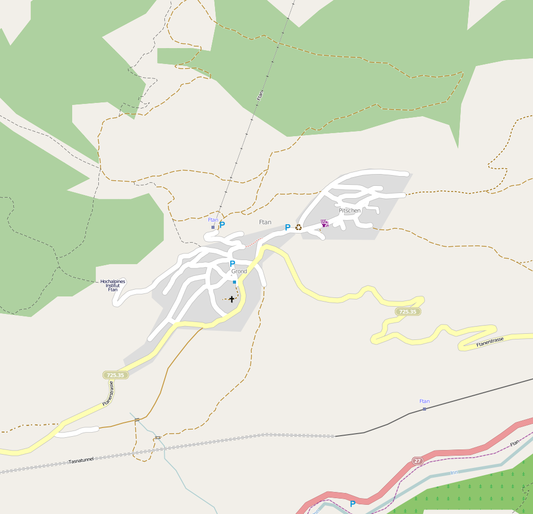
A good example of the difficulties is the small mountain village Ftan where we customarily spend our annual skiing vacation.
Essentially none of the roads have road signs, nor do they actually have names. The full addresses use a “quarter” name in place of a street name. As can be seen from the list produced by my statistics (original file: http://qa.poole.ch/ch-roads/ftan-20130119.htmlcurrent version: http://qa.poole.ch/ch-roads/GR/3761.html switch to the Mapquest Open map on the OSM site to see what was actually added) nearly all the missing features are not roads, that dosen’t stop Google showing street names (google maps) where there aren’t any.
Surveying such data is going to take time, it implies using local knowledge and other clues available on the ground. It will be interesting to see how much can be gathered in the week I will be on site and how we progress with the multitude of similar settlements over the next months.
The virtual machine (heidi.sosm.ch) running the SOSM web site, mail server and the mapproxy service has moved to a different host machine. If there are any issues please send mail to tech@sosm.ch
The last numbers on development of the OSM coverage in Switzerland were from early 2012. Since then we have had on the one hand the licence change process with a small corresponding loss of data, and on the other hand quite a lot of interest in the project as a whole. So I beleive an update is in order. While I didn’t use quite the same methodology as the previous numbers presented in the wiki here, they seem close enough to be comparable.
The statistics show an increase of a total of at least 10’000 km from 142’000 km at the beginning of the year to 152’000 km now. This without taking a further 8’000 km of “service” roads in to account that were not listed separately in previous statistics. As would be expected the length of all roads with higher classification does not show much movement, a clear indication that the major road network is very complete.
The low number for the length of combined footway/cycleway would seem to indicate that we are mistagging the most frequent occurring type of cycleway.in Switzerland. What is further slightly surprising is that we have mapped a combined length of 1500 km of driveways and parking aisles, this would seem to be an awful lot compared to roughly 1300 km of cycleways.
Detailed Numbers
OSM classification
length (km)
length (km)
motorway
1’505
50% of the length of one-way segments
3’003
one-way segments counted fully
motorway_link
333
“
665
“
trunk
361
“
511
“
trunk_link
50
“
95
“
motorway + trunk
2’249
4’274
primary
4’798
includes _link
secondary
5’450
“
tertiary
10’919
“
unclassified
16’539
“
residential
23’576
service
6’590
service=alley and unspecified
driveway
720
service=driveway
parking aisle
782
service=parking_aisle
track
12’254
tracktype unspecified, neither foot or bicycle = designated
track grade 1
9’461
neither foot or bicycle = designated
track grade 2
17’220
“
track grade 3
9’588
“
track grade 4
2’627
“
track grade 5
1’733
“
track total
52’883
path
19’183
neither foot or bicycle = designated
pedstrian
327
footway
6’506
plus path and track with foot=designated
cycleway
1’078
plus path and track with bicyle=designated
combined cycleway / footway
250
track, path, cycleway and footway either with explicit or implicit designated values for foot and bicycle